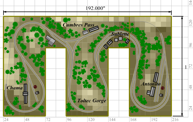
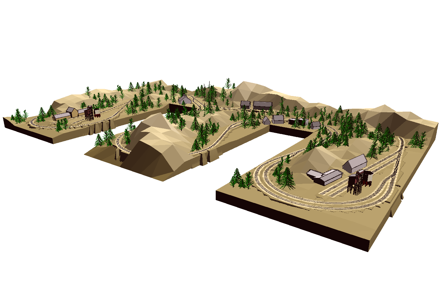
| Here is a large
layout showing the use of Figure Terrain grids. There are 2' aisles
with 4' bench tops. The center section drops vertically to represent
Toltec Gorge on the D&RG. Meanwhile the rear rises to the top of Cumbres
Pass.
Tree Symbols have been used for the mountainous landscaping. The symbols
auto-elevate based on the terrain.
Download Plan 18.exe (184 kb)
These
files require Cadrail Version
10 or the Cadrail 10 Demo to view and print.
How to use these
self-extracting files
| Note: this is a complex drawing with lots of detail.
The time needed to draw is dependant on the speed of your computer. These large files, take longer to draw
on the screen. |
|